 |
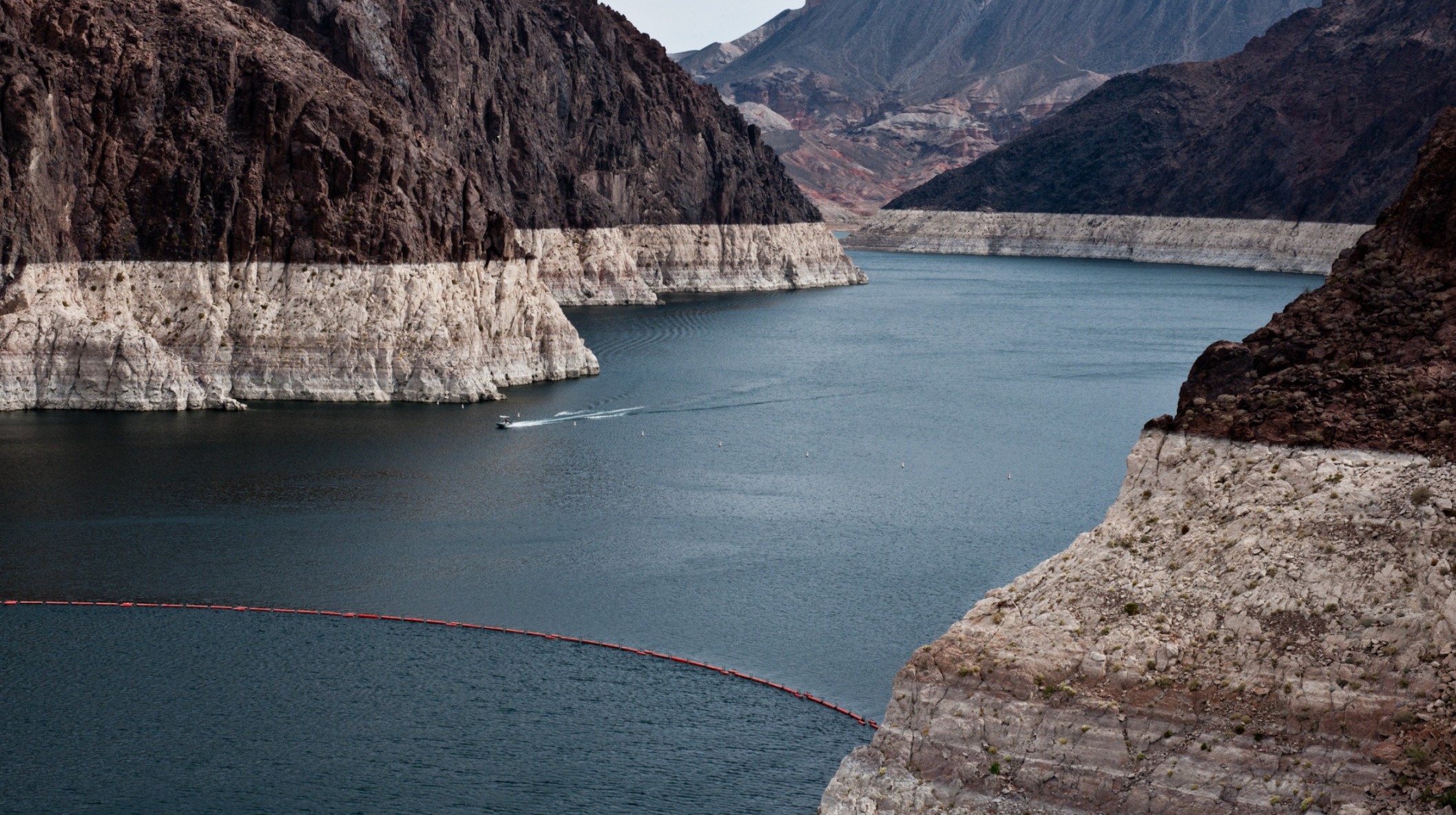
| The Colorado River Basin lost nearly 53 million acre feet of freshwater over the past nine years, according to a new study based on data from NASA’s GRACE mission. This is almost double the volume of the nation’s largest reservoir, Nevada’s Lake Mead (pictured). Credit: U.S. Bureau of Reclamation |
agu | A new study finds more than 75 percent of the water loss in the drought-stricken Colorado River Basin since late 2004 came from underground resources. The extent of groundwater loss may pose a greater threat to the water supply of the western United States than previously thought.
This study is the first to quantify the amount that groundwater contributes to the water needs of western states. According to the U.S. Bureau of Reclamation, the federal water management agency, the basin has been suffering from prolonged, severe drought since 2000 and has experienced the driest 14-year period in the last hundred years. The study has been accepted for publication in Geophysical Research Letters, a journal of the American Geophysical Union, which posted the manuscript online today.
The research team, led by NASA and University of California, Irvine, scientists, used data from NASA’s Gravity Recovery and Climate Experiment (GRACE) satellite mission to track changes in the mass of the Colorado River Basin, which are related to changes in water amount on and below the surface. Monthly measurements of the change in water mass from December 2004 to November 2013 revealed the basin lost nearly 53 million acre feet (65 cubic kilometers) of freshwater, almost double the volume of the nation’s largest reservoir, Nevada’s Lake Mead. More than three-quarters of the total — about 41 million acre feet (50 cubic kilometers) — was from groundwater.
“We don’t know exactly how much groundwater we have left, so we don’t know when we’re going to run out,” said Stephanie Castle, a water resources specialist at the University of California, Irvine, and the study’s lead author. “This is a lot of water to lose. We thought that the picture could be pretty bad, but this was shocking.”
Water above ground in the basin’s rivers and lakes is managed by the U.S. Bureau of Reclamation, and its losses are documented. Pumping from underground aquifers is regulated by individual states and is often not well documented.
“There’s only one way to put together a very large-area study like this, and that is with satellites,” said senior author Jay Famiglietti, senior water cycle scientist at NASA’s Jet Propulsion Laboratory (JPL) in Pasadena, California, on leave from UC Irvine, where he is an Earth system science professor. “There’s just not enough information available from well data to put together a consistent, basin-wide picture.”
Famiglietti said GRACE is like having a giant scale in the sky. Within a given region, the change in mass due to rising or falling water reserves influences the strength of the local gravitational attraction. By periodically measuring gravity regionally, GRACE reveals how much a region’s water storage changes over time.
The Colorado River is the only major river in the southwestern United States. Its basin supplies water to about 40 million people in seven states, as well as irrigating roughly four million acres of farmland. Fist tap Dale.


0 comments:
Post a Comment